Merdeka Bridge
A historic link across the Muda River memorable for its bowstring design

This is quite likely the oldest road connection across the natural water boundary separating Penang and its neighbouring state of Kedah. It is also one of the most historic inter-state links in Malaysia.
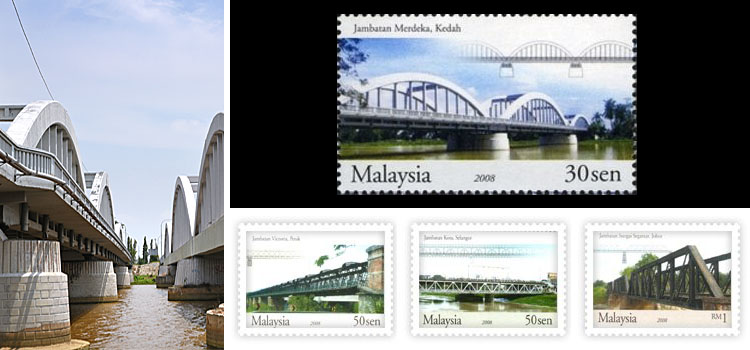
The Merdeka Bridge was so named as it was intentionally launched in 1957, the very year Malaysia attained independence from the British. The structure had already been completed and opened in 1955.
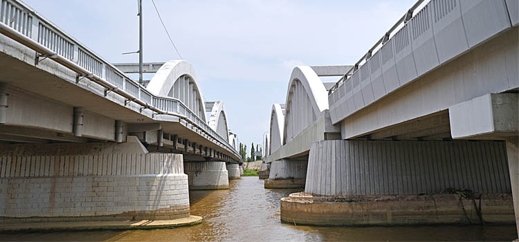
Known to locals as Titi Merdeka, the 350-metre bridge stretches across the mighty Sungai Muda river, just next to where the waterway twists into a fancy U-shaped bend. It should be noted that this 120km-long river, the longest in Kedah, cuts across the entire border between the northern part of the state and Penang. This bridge was therefore considered an infrastructure landmark when it was first built as allowed vehicles to be driven over the waterway.
On the river’s southern bank is the rural backwater of Bumbung Lima in Penang’s Seberang Perai district; on the northern side is a scenic farming enclave in the Kota Kuala Muda district of Kedah.
Merdeka Bridge is a key segment of the well-known old trunk road called Federal Route 1, the earliest public roadway in the country whose construction began in the 1880s. Despite the opening of the modern tolled PLUS highway (the North-South Expressway) in 1994, many people still prefer to use this idyllic old route to ply anywhere between the towns of Alor Setar and Sungai Petani in Kedah, and Butterworth in Seberang Perai.
The bridge was built fifteen years after another bridge at the same location was demolished in 1942, during the Japanese occupation of the Second World War. Due to its historic value, it was featured in a special commemorative stamp issued by Pos Malaysia in 2008.
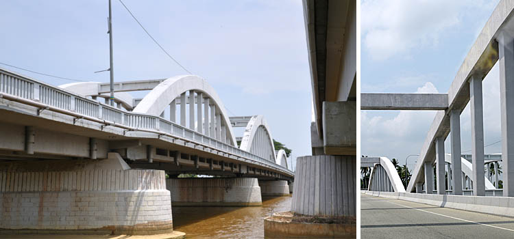
Intriguingly, the current link we see today is not really a single structure but a pair of bridges. It consists of two separate but identical physical spans, constructed years apart, parallel to each other.
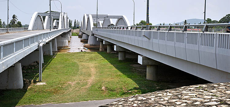
When the span on the west was designed and erected by the Public Works Department in 1955, it catered for traffic in both directions. As the volume of vehicles using this structure increased considerably, the other span was added a few years later. The older span is now meant only for traffic heading northward, while the newer one accommodates vehicles being driven southward.
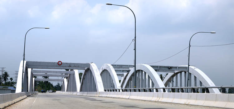
Aesthetically, the Merdeka Bridge has a rather eye-catching geometric frame. Its concrete truss girder design is characterised by multiple bowstring-shaped deck arches that give a pleasant curvy visual look to the overall structure.
Today, the famous bridge is significant for both its form and its function. It has become an iconic historic landmark while also serving as an important conduit for the transportation of people and goods between the two states over the Muda river.
Unfortunately, there is no discernible signage to inform users and passers-by on the significance of this bridge. It would certainly help to instil appreciation and pride among local and travellers alike on the little-known legacy of this historic icon.
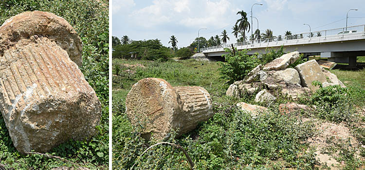
Incidentally, a few yards from the bridge on its southern side, are some mysterious remains of a heavy column with intricate classical European carvings and a pile of concrete rubble. These remnants raise questions about what had existed here and whether it was also demolished, like the original bridge structure, during the Japanese occupation.
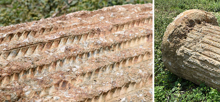
However, because of its relatively well-preserved appearance it may be possible that the plinth-like structure was brought here to be dumped from elsewhere on this grassy bank of the river.
-------------------------------------------
Written by Himanshu Bhatt
Photographed by Adrian Cheah